Summer Vacation 2021 - New York Central and Erie ghosts around Franklin and Oil City
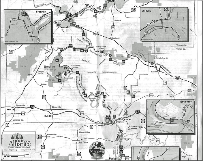
1. Bottom half of the oil region map that I inserted previously. Pay special attention to the Sandy Creek Trail (former NYC) at the end of Belmar Road and the Allegheny River Trail (former PRR). The Samuel Justice Trail out of Franklin would also be PRR. Oil Region map Belmar Franklin. Click here for a larger image.
Next we will visit the Belmar Bridge. How did I find out about this place? We picked up a bunch of tourism brochures and booklet when we entered PA on I-80. I looked at our DeLorme Gazetteer and figured is was close by Franklin where we were staying the night.
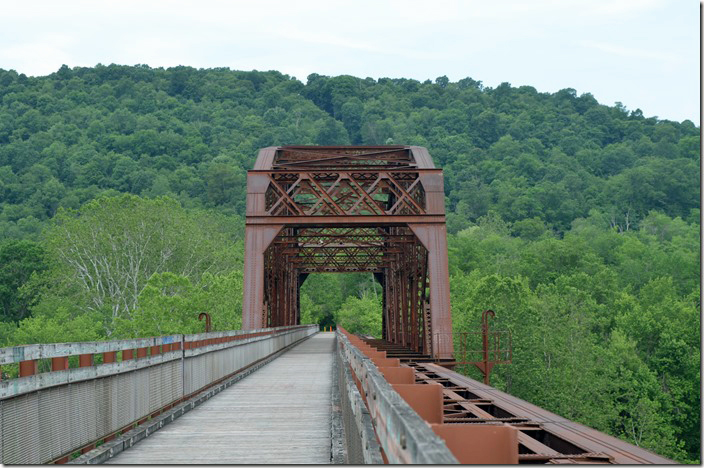
2. Belmar PA bridge. Eastward.
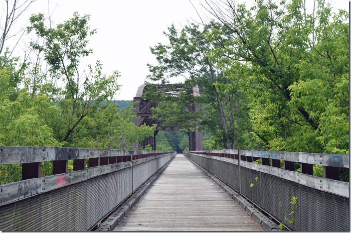
3. Built for double track which it never was. Looking east toward Brookville. Belmar PA bridge. Monday, 06-21-2021.
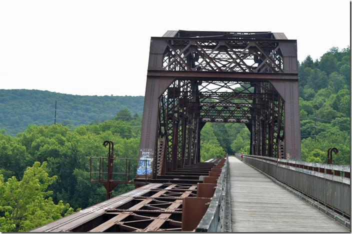
4. The former PRR Allegheny River line which is now another trail. The PRR and NYC never connected here but the rail trails do. Belmar PA bridge PRR.
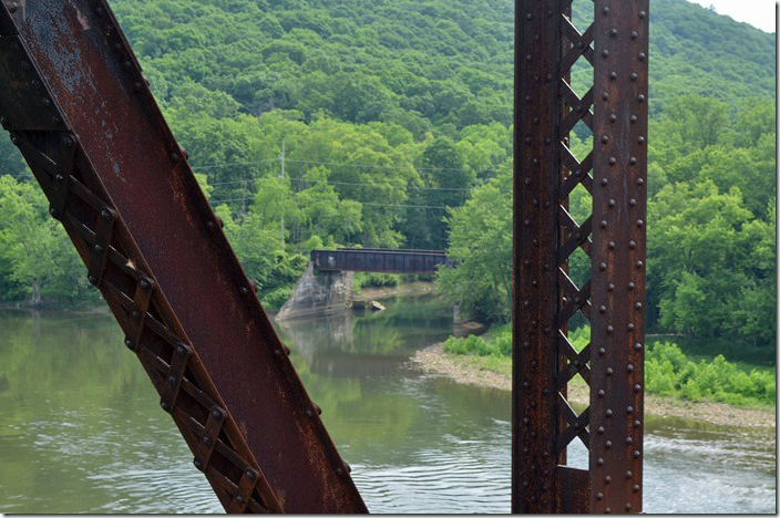
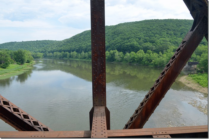
5. Looking up the Allegheny River at Belmar PA with the PRR on the right.
6. Looking west. Belmar PA bridge.
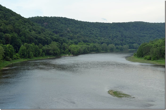
7. Looking down the Allegheny River toward Pittsburgh. Belmar PA.
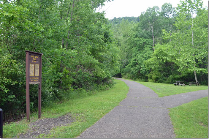
8. Sandy Creek rail trail veering off to the left. Parking to the right. Belmar PA.
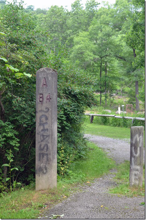
9. NYC mile post “Brookville 51” looking east. Belmar PA.
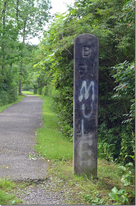
10. Backside indicating Ashtabula OH, 84 miles. Belmar PA NYC MP.
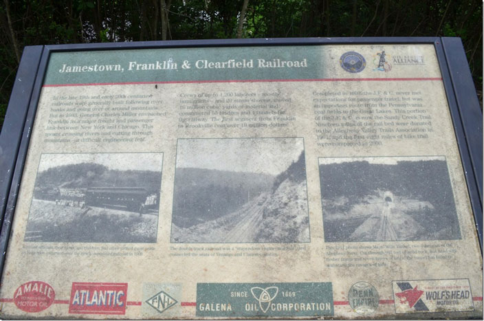
11. Belmar PA historic marker. The JF&C was acquired by the NYC 01-01-1915. Click here for a larger image.
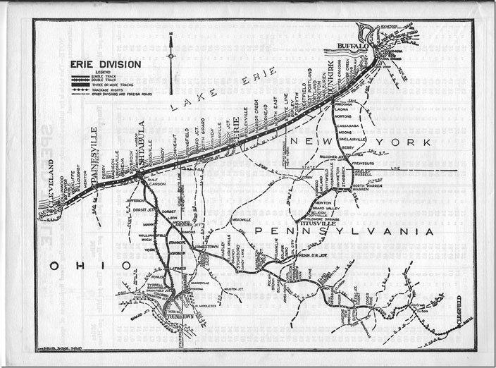
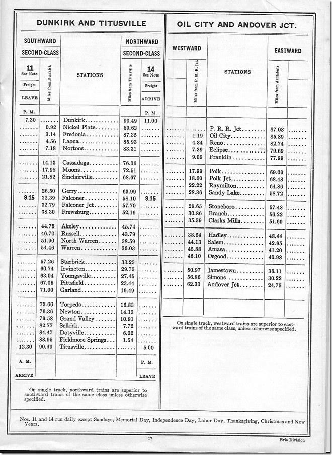
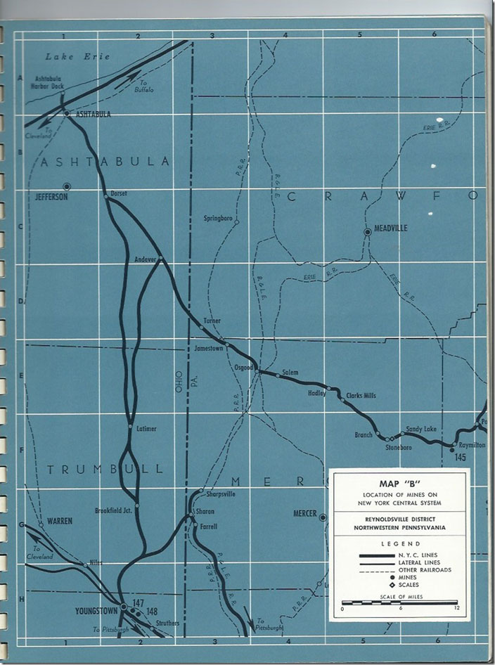
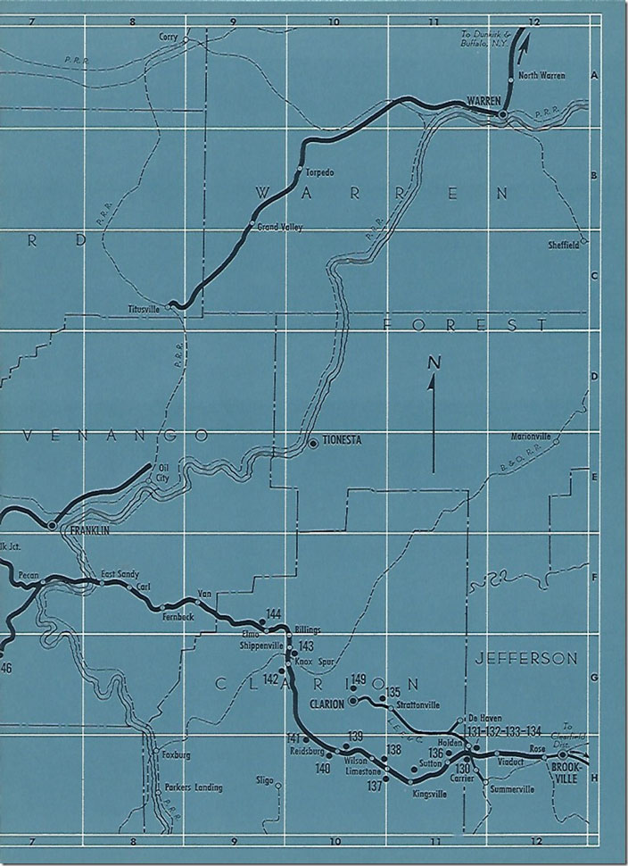
12. NYC Erie Division map from the 1951 employee timetable. The official end of the line was Rose which is on the outskirts of Brookville. Also note NYC’s connection with the Lake Erie, Franklin & Clarion (LEF&C), a coal-hauling shortline that worked until the 1990s. Also note the Erie branch coming south out of Meadville that reached Oil City. Click here for a larger image.
13. NYC Erie Div. employee timetable for 1951. Oil City-Andover.
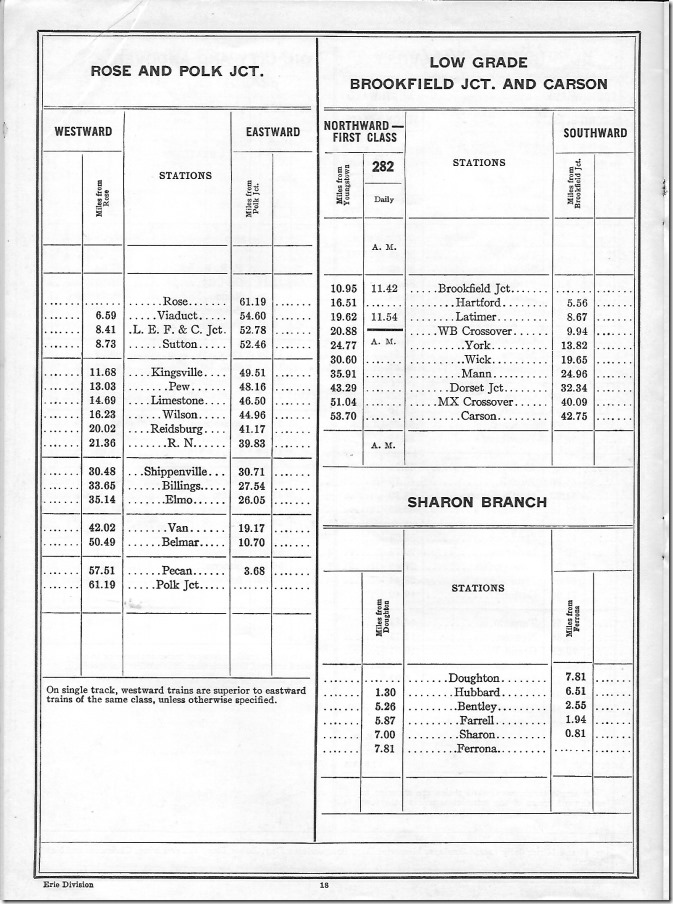
14. Polk Jct. (near Franklin) to Rose. NYC Erie Div Rose-Polk Jct 1951.
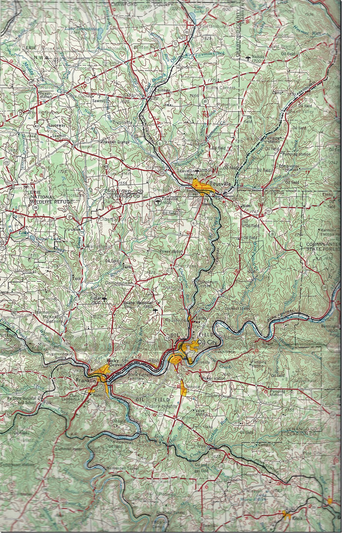
15. USGS Warren 1:250,000 scale map circa Penn Central era in 1967. USGS Warren Quad Oil City Titusville. Click here for a larger image. (6)
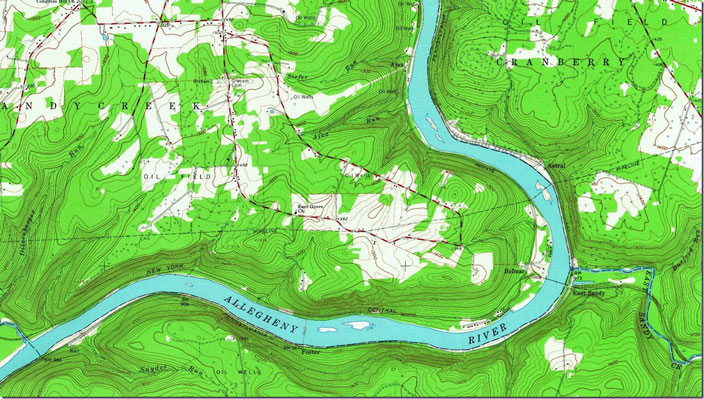
16. Kennerdell 15 min. topo showing the Belmar bridge area in 1963. Kennerdell PA, 1:24,000 quad, 1963, USGS. Click here for a larger image.
17. NYC coal directory from the mid-50s. NYC Reynolds Dist. Click here for a larger image.
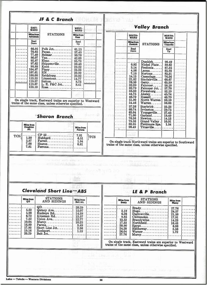
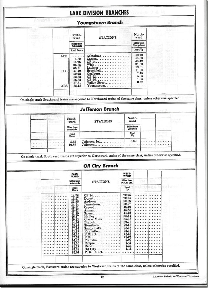
18. Note the NYC reaching Titusville from Dunkirk NY, through Warren. No sign of it now. NYC Reynolds Dist. Click here for a larger image.
19. NYC Lake Division branches from the 1966 employee timetable. NYC has given the initials of “JF&C” Branch for the former Jamestown, Franklin & Clearfield Railroad. Click here for a larger image.
20. NYC Oil City Youngstown Br 1966. Click here for a larger image.
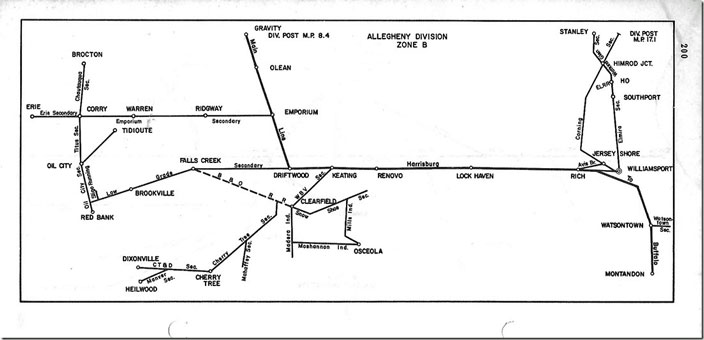
21. Penn Central Valley Division map ca. 1974. This encompasses former PRR and NYC track. The division connects with adjacent divisions not shown. Click here for a larger image.
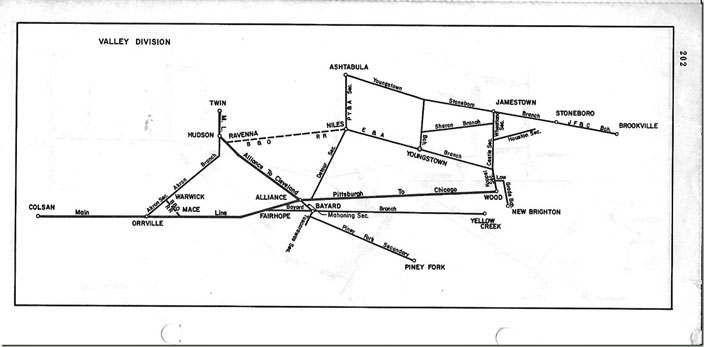
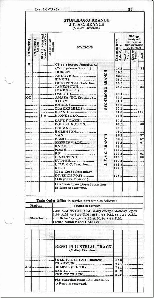
22. In this timetable ca. 1974 the PRR lines from Brocton to Red Bank are intact. The Salamanca Br. up the scenic Allegheny River from Oil City to Warren has been severed at Tidioute. PC Allegheny Div map. Click here for a larger image.
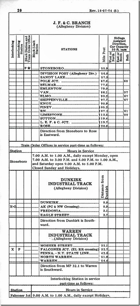
23. The Oil City segment has been cut back to Reno, half way between Franklin and Oil City. P-C will now use the parallel Erie-Lackawanna to reach Oil City. I think there was the remains of an oil refinery at Reno. PC Stoneboro JF&C Reno 1975.
24. The JF&C Branch still goes to Rose, but the LEF&C coal hauling shortline cab be reached off the Pennsy “Low Grade” from Brookville. PC JF&C Br 1974.
25. Franklin and Oil City are now served by the Western New York & Pennsylvania Railroad over the former Erie branch from Meadville. Looking west toward Meadville.
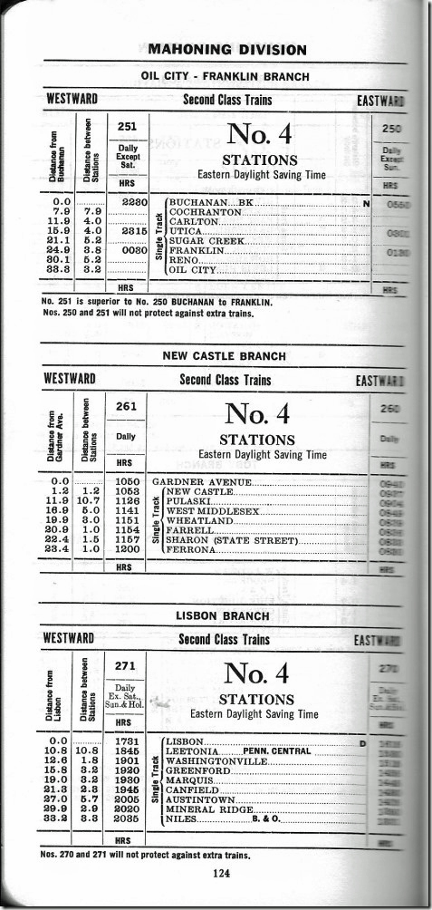
26. E-L Mahoning 1974.
27. The E-L Oil City – Franklin Branch is what the WNY&P acquired from Norfolk Southern. E-L Mahoning 1974.
28. Erie Mahoning 1960.
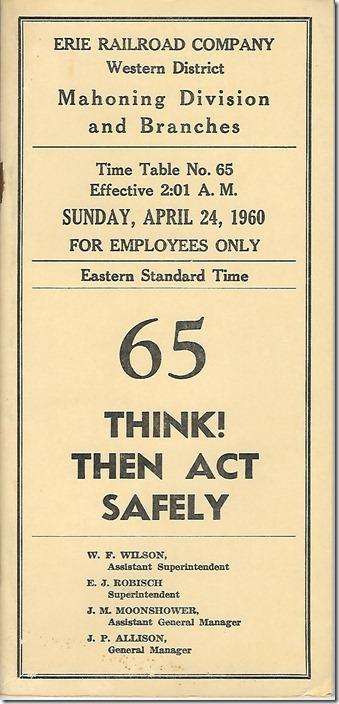
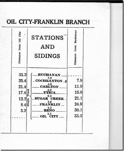
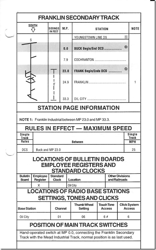
29. Erie Mahoning Oil City Br 1960.
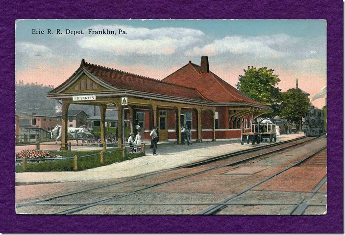
30. Conrail Franklin Secondary.
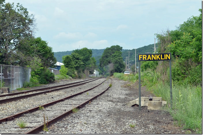
31. Erie depot. Franklin PA. 1917.
32. Franklin PA, 1:24,000 quad, 1963, USGS. Click here for a larger image.
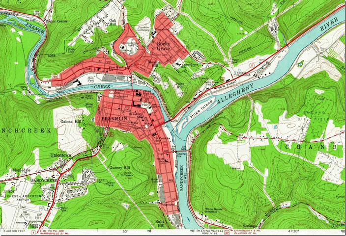
The NYC winding through town is gone, but the bridge out of town across French Creek beside PA 8 is still there. The NYC and Erie ran side by side up the narrow valley to Oil City. The Pennsy Allegheny Branch is gone. Erie depot was presumably beside Atlantic Ave. (Atlantic & Great Western RR) near the ball park.
33. LS&MS tunnel Oil City PA.
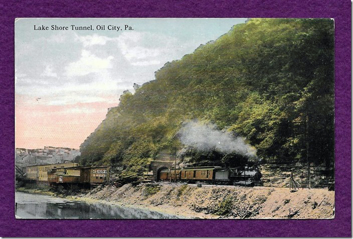
Lake Shore & Michigan Southern (NYC) operated to the north side of Oil City until abandoned in 1967. From exploring on-line websites the west end of the tunnel is partly barricaded by degree. We didn’t see it coming in on US 62. PA 8 slices around this end of the hill, and there is no evidence of this portal.
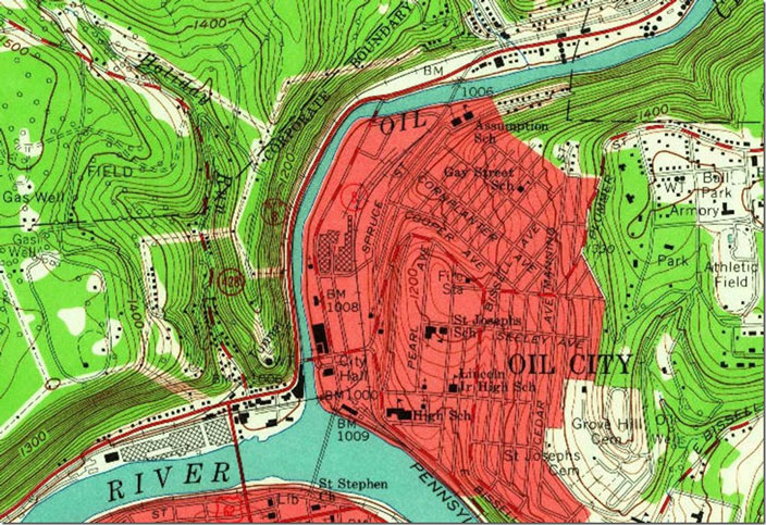
34. The Lake Shore Tunnel is shown in this 1963 topo as is the Erie bridge across the mouth of Oil Creek into downtown and a junction with the Pennsy. Those steep contours in the lower left sure don’t leave much room for two railroads and a state highway! Oil City PA, 1:24,000 quad, 1963, USGS. Click here for a larger image.
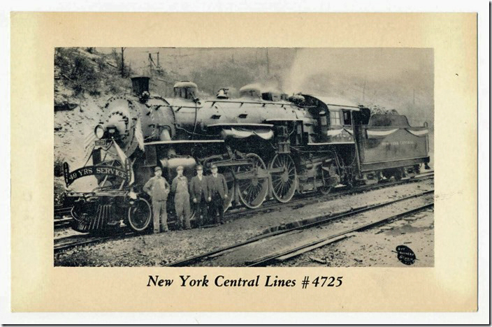
35. Supposedly taken at Oil City commemorating the service anniversary of one of the crew. NYC 4725. Oil City PA.
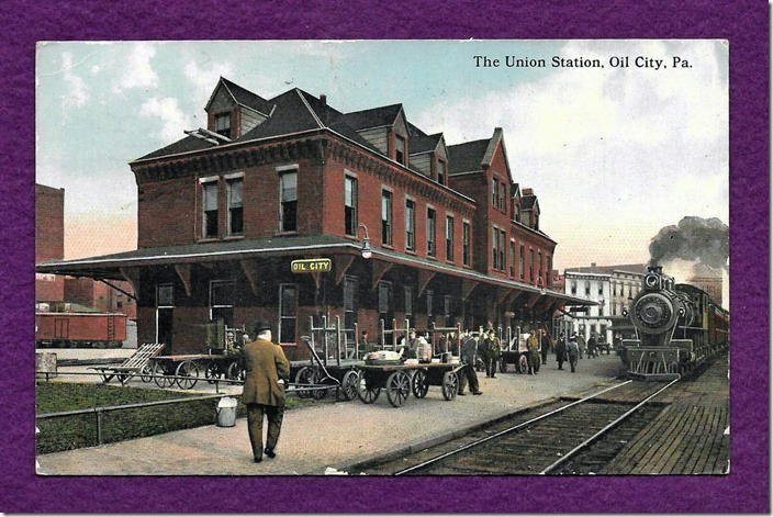
36. Used by PRR and Erie, but the NYC List of Stations and Other Facilities for 1943 doesn’t show them sharing. PRR depot Oil City PA.
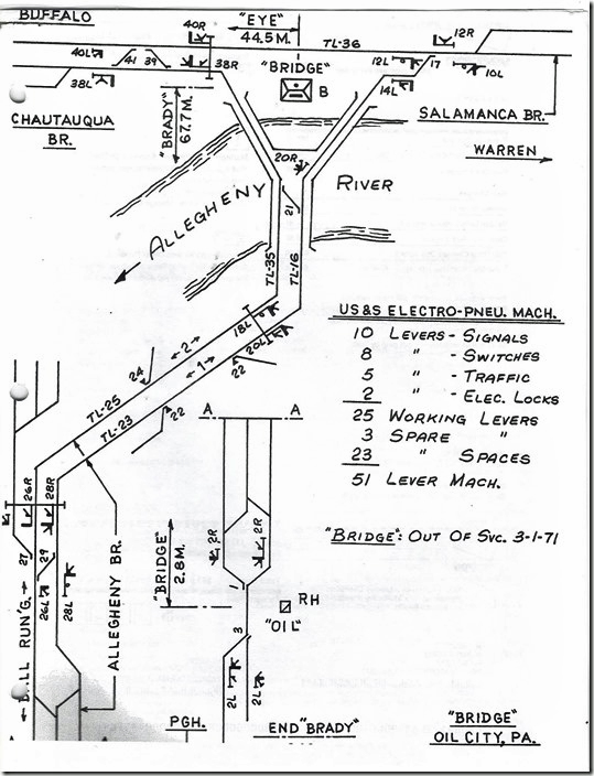
37. Penn Central “Bridge” interlocking. Note that it was out of service as of 03-01-1971. PRR interlocking Oil City Bridge.
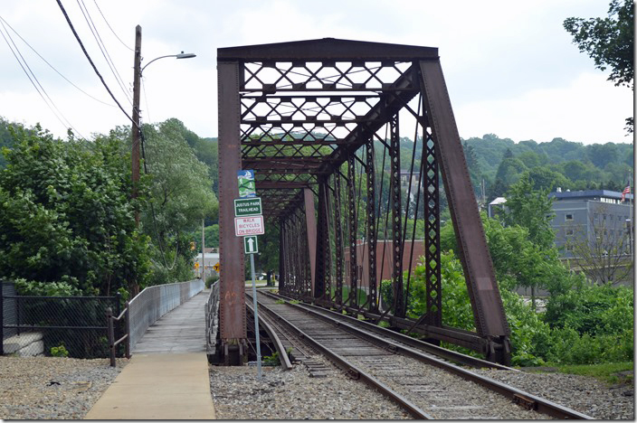
38. WNY&P Oil Creek bridge built by the Atlantic & Great Western (Erie predecessor) ca. 1892. Looking east toward downtown. Eastward. Oil City PA. 06-21-2021.
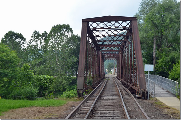
39. WNY&P Oil Creek bridge looking toward Franklin. A WNY&P track man was parked on the other side of the bridge. He said WNY&P comes in a couple of times a week. They serve the Sasol refinery (former Pennzoil or Quaker State) refinery north of town on PA 8. WNY&P also serves an industry down the old P-C, nee-PRR truncated Allegheny Branch from Bridge Jct. Oil City PA. Westward.
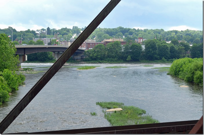
40. Confluence of Oil Creek and the Allegheny River at Oil City. Oil City PA WNY&P bridge Oil Creek. 06-21-2021.
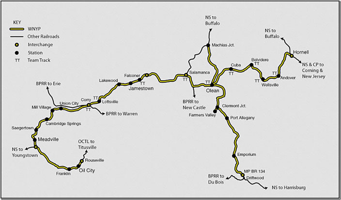
41. Map of the Western New York & Pennsylvania Railroad. The line from Meadville to Hornell NY is the former Erie-Lackawanna, nee-Erie main line. Driftwood to Machias Jct. is former NS nee-PRR Buffalo Line. Meadville (Buchanan) to Oil City is former E-L with a short segment of the PRR to Rouseville. Click here for a larger image.
We are heading up US 62 to Warren, Bradford, and Kinzua Bridge State Park.
Train images used by permission of Everett N Young