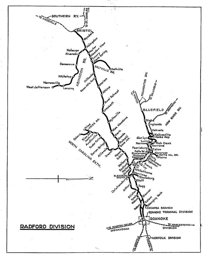
N&W - Exploring the Virginia Creeper Trail and the Abingdon Branch
One priority on our Carolina vacation trip during December 2015 was to check out N&W’s abandoned Abingdon Branch. While others took photos, O. Winston Link immortalized this sylvan and bucolic backwoods branch line like no other on the N&W or perhaps any railroad. I have all of his books and several vintage Radford Div. employee timetables, but heretofore the Abingdon Branch was only images on paper. Regretfully I never visited the line before its abandonment in 1977. Work and finances took precedent then. This would be an opportunity to get a feel for this historic railroad.
We stayed the evening of Thursday, 12-03-2015, in Abingdon. With a few hours of daylight remaining on this late fall day we headed out US 58 to explore.
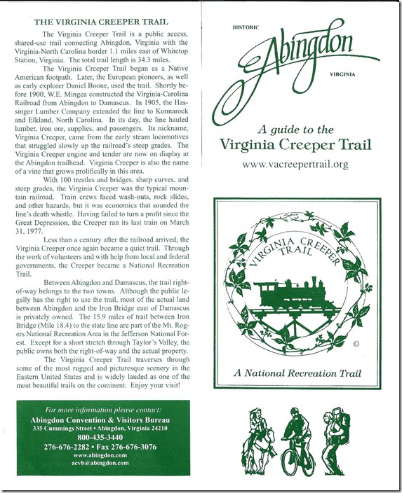
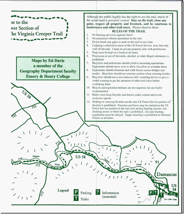
1. Virginia Creeper Trail guide - page 1.
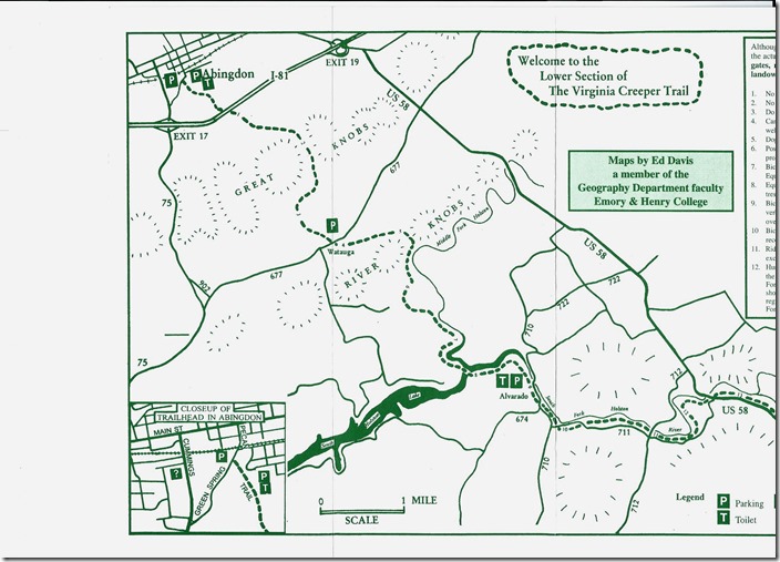
2. Virginia Creeper Trail guide - page 2.
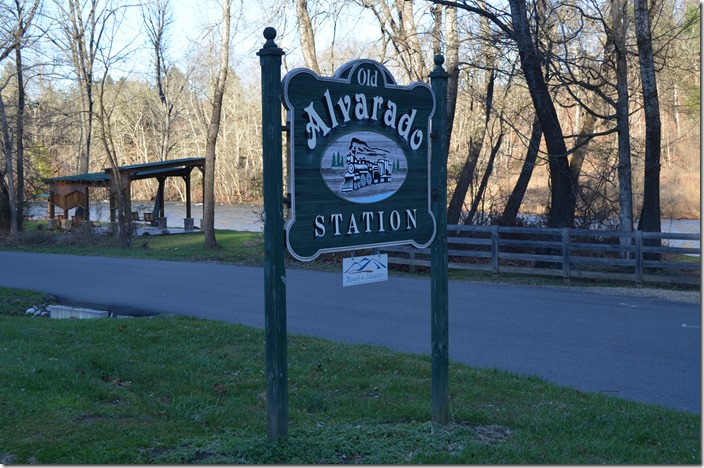
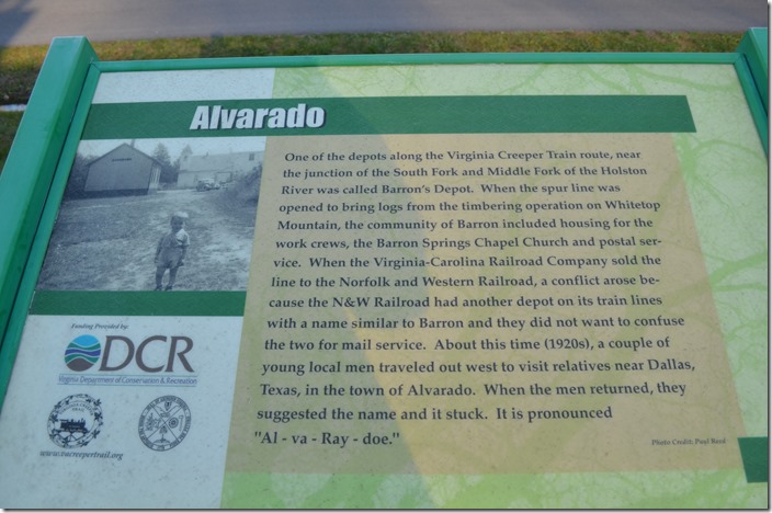
3. Virginia Creeper Trail - Old Alvarado Station sign.
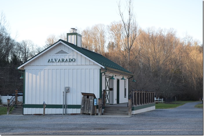
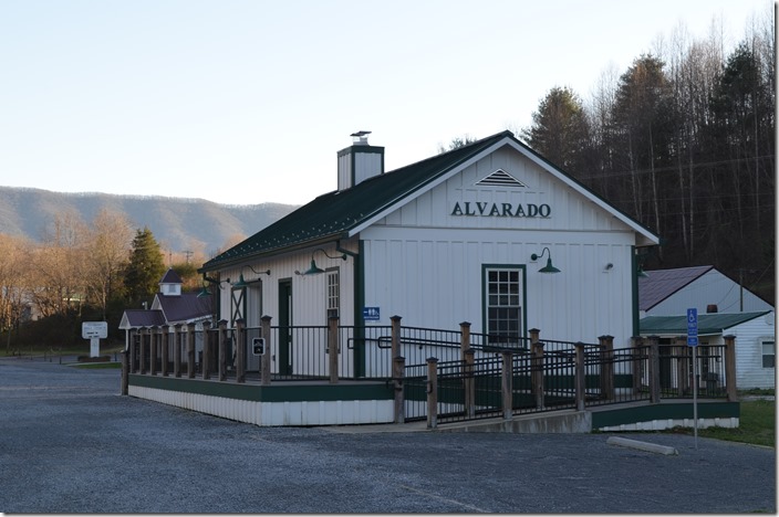
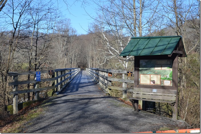
4. Our first stop was this structure at Alvarado VA. From photos in "The Last Steam Railroad In America" it doesn’t appear to be the 1950's depot. It is similar, but not the real thing. It has restrooms, etc. for those enjoying the trail. Depot Alvarado VA.
5. Virginia Creeper Trail - Naming Alvarado - marker. 1794
6. Depot. Alvarado VA. View 2.
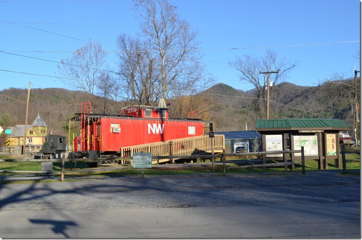
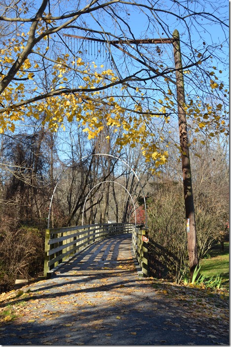
7. Our next stop was Damascus VA, located at milepost 16 on the Abingdon Branch. Virginia Creeper Trail. Alvarado.
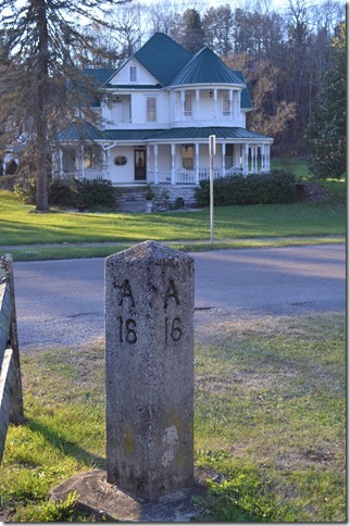
8. NW milepost A16. Damascus VA.
9. Virginia Creeper Trail guide - page 3.
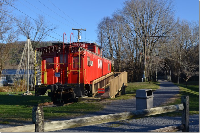
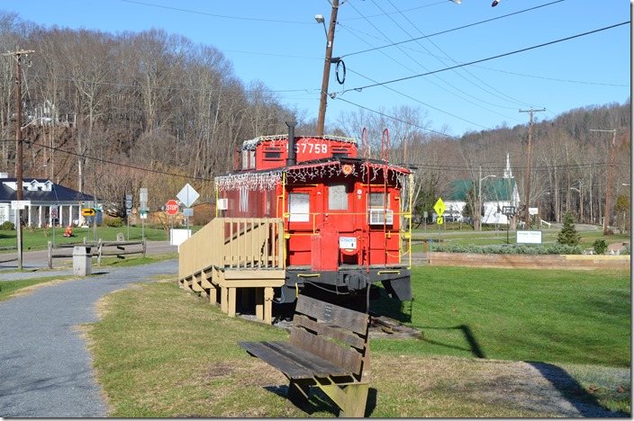
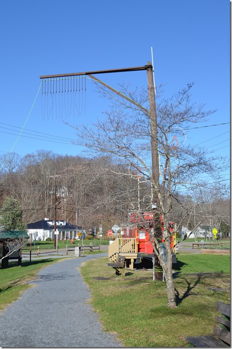
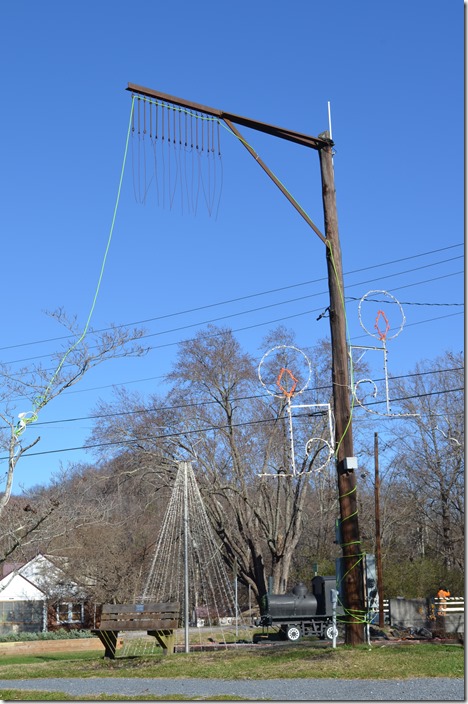
10. This former Wheeling & Lake Erie caboose is sitting beside the old roadbed. To the right is the Damascus city park. NW caboose 557758. Damascus VA.
11. Looking south at the old right-of-way, tell-tale, and truss bridge over Beaverdam Creek. 12-03-2015. NW cab 557758. Damascus VA.
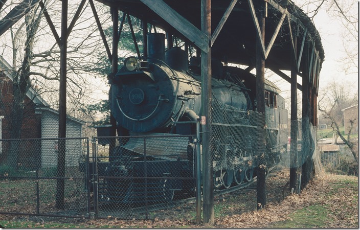
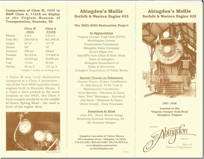
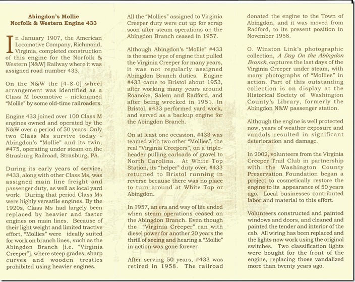
12. N&W class M 4-8-0 no. 433 on display at Abingdon on 11-25-1988. We forgot to go over there this time. N&W 433. Abingdon VA.
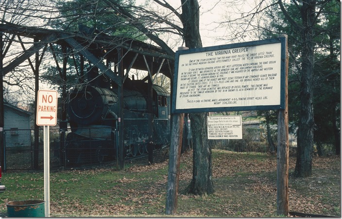
13. N&W 433. Abingdon VA. View 2.
14. Virginia Creeper Trail. Info sheet 6.
15. The next morning, Friday, 12-04-2015, we headed over the back roads to Watauga VA.
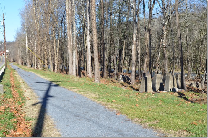
Virginia Creeper Trail. Info sheet 7.
16. Looking north from VA 677 at NW bridge over Fifteen Mile Creek at Watauga VA.
17. NW bridge. Watauga VA.
18. Concrete foundations for the water tank that once stood at the north end of Damascus. It isn’t listed in the 1950's employee timetables. NW water tank footers. Damascus VA.
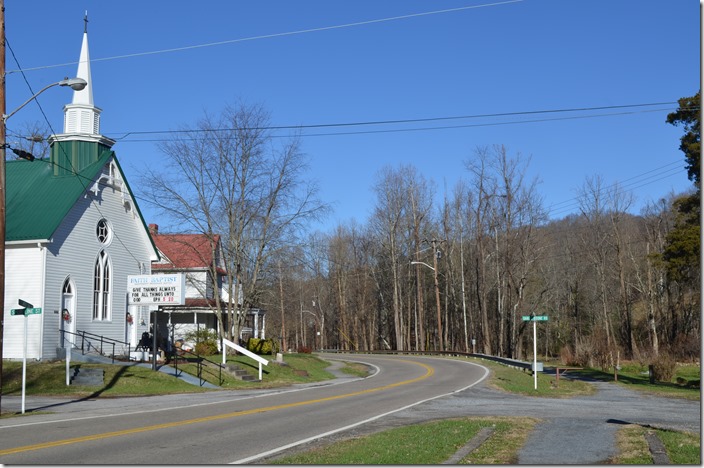
19. It was a Lutheran Church in Link’s photo. The water tank was just beyond the crossing. NW roadbed & church. Damascus VA.
20. Former N&W caboose was built by the W&LE at their Ironville (Toledo) shop in 1949. It was donated to the city of Damascus in 1990. The church is in the background. N&W cab 557757. Damascus VA.
A spur exited the main line behind the milepost and along the street to the left. The depot was along the spur (State Line Br. in 1930 emp. timetable). This was actually the main line in 1901. Virginia-Carolina Ry. continued a short distance to the Tennessee state line. A lumber company took over most of this and extended the railroad further up the creek to Crandull TN, under the name of Beaver Dam R.R. V-C let Beaver Dam have the line except for yard limits in Damascus. Link’s photo on page 101 of The Last steam railroad... shows a lumber mill south of the depot. The Beaver Dam R.R. had long since been abandoned by this time.
21. A once-common tell-tale. N&W tell-tale. Damascus VA.
22. N&W tell-tale. Damascus VA. View 2.
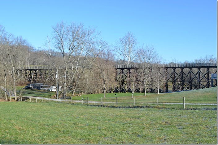
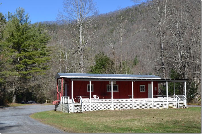
23. N&W bridge over Beaver Dam Creek. The extension out of Damascus began in 1904. N&W bridge. Damascus VA.
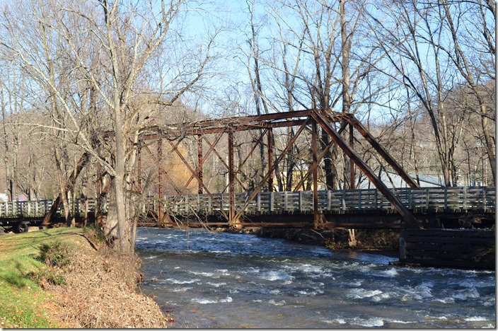
24. N&W bridge. Damascus VA. View 2.
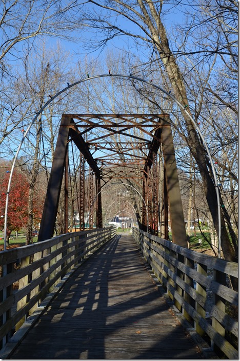
25 South end of the bridge in Damascus. N&W tell-tale. Damascus VA.
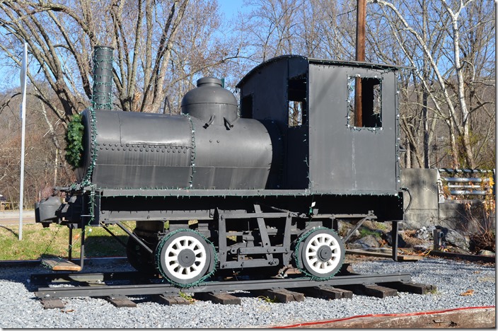
26. I’m at a loss to identify this one. Had a chain drive from inside the “boiler” and some rudimentary controls inside the cab. Must have been used at the lumber mill. logging loco. Damascus VA.
27. An old N&W wreck train tool car is used at this public building along the trail at Taylor’s Valley VA. ex-N&W tool car. Taylors Valley.
28. N&W bridge. Creek Jct VA.
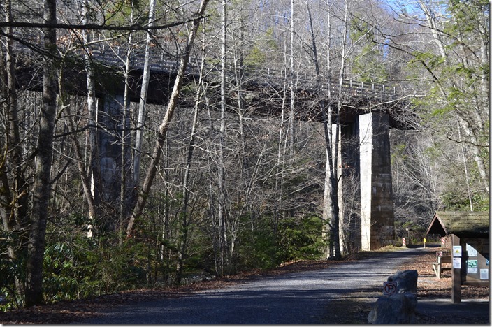
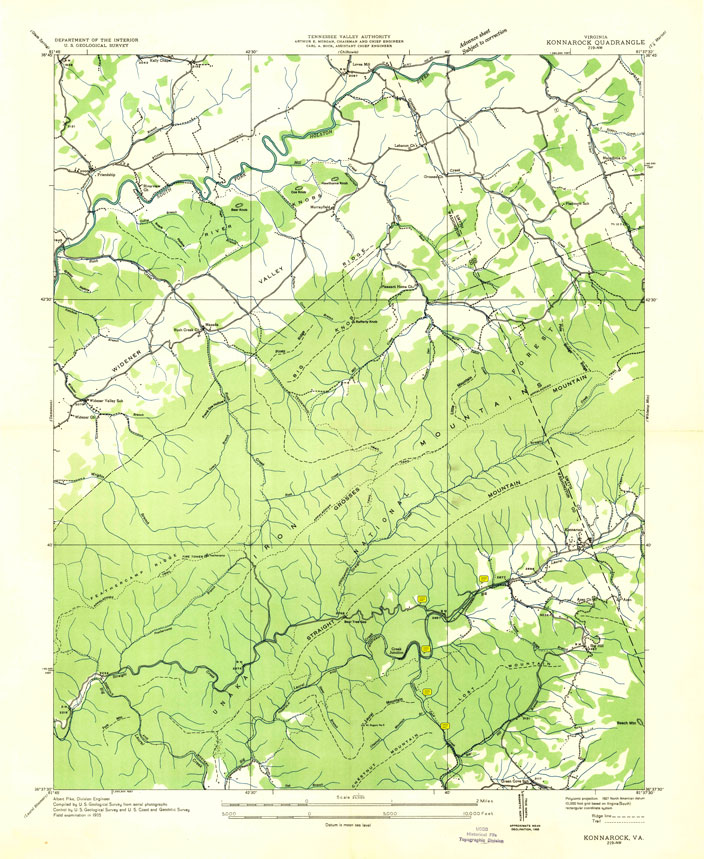
Initially V-C used the roadbed in the foreground to reach the end-of-line at Konnarock in 1907. The last couple of miles from Grassy Ridge to Konnarock were shared with the White Top Ry. which was owned by Hassinger Lumber Co. In 1915 V-C (now owned by N&W) extended their line south into North Carolina. This extension left the original line at Creek Junction, a mile or so north of this location, and started the steep climb to White Top over this impressive trestle. The segment in the foreground up to Konnarock became a branch. See the attached employee timetables and the PDF of the 1935 topo map with my “sticky notes.”
29. N&W Employee Timetable 1930 - page 1.
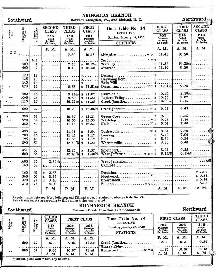
30. N&W employee Timetable 1930 - page 2.
31. N&W Employee Timetable 1940.
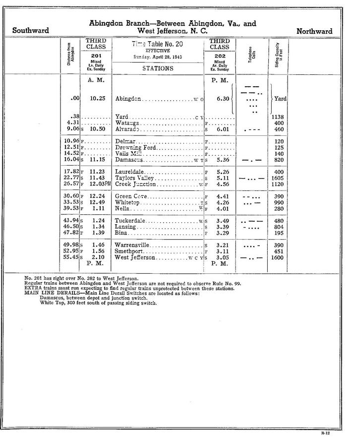
32. N&W Employee Timetable 1963.
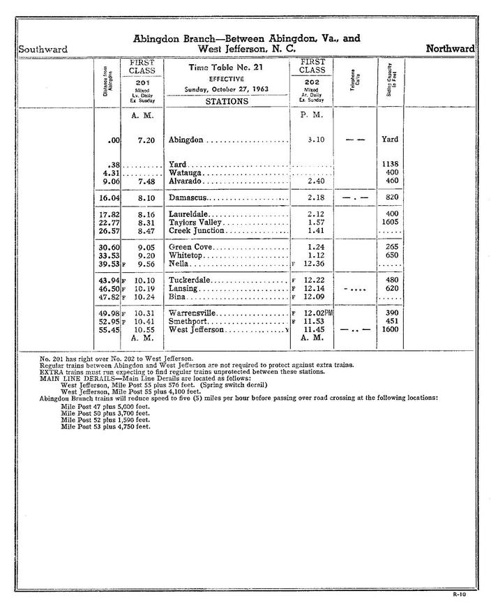
33. N&W Employee Timetable 1963 - system map.
34. N&W USGS VA Konnarock Quadrangle Topographic map - 1935. Image only. PDF (with notes) is at the end of web page, paragraph 57.
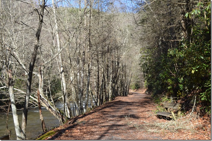
35. Looking north along White Top Laurel Creek toward Creek Junction. Original V-C and N&W right-of-way to Konnarock. NW roadbed. Creek Jct VA.
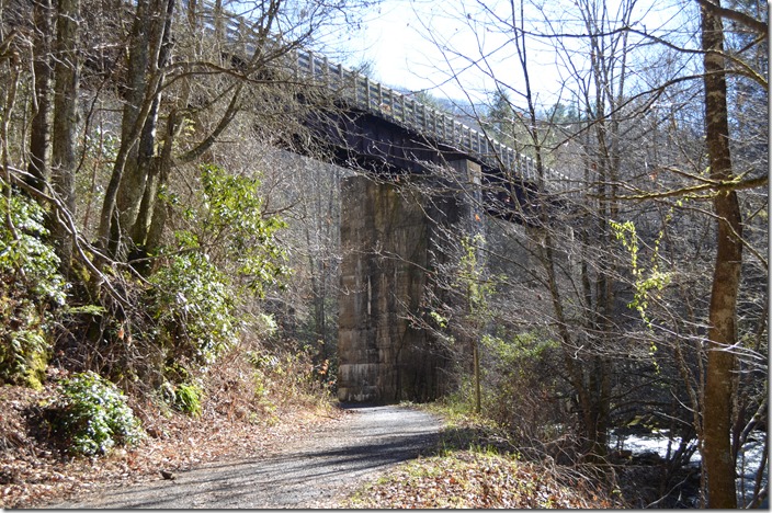
36. The Abingdon Branch will now follow Green Cove Creek to the right. The Konnarock Branch (foreground) was abandoned in the ‘30s. NW bridge. Creek Jct VA.
In following VA 859 from Taylor’s Valley, we crossed the Trail south of Creek Jct. Almost immediately the road (gravel) clung to the side of the hill while the N&W descended along the creek. After we drove through a few small cuts, it became apparent that the current road 859 uses an old railroad grade! We intersected US 58 at what must have been Grassy Ridge. Subsequent research reveals that this abandoned grade was the White Top RR that may have also gone as far as Green Cove. No other point of contact is mentioned with V-C or N&W other that Grassy Ridge. We didn’t go back that route, so I didn’t take any photos. The valley really widens out at Konnarock which has an interesting history of its own. We stopped at the K-Rock Community Store and dined on hot dogs and potato chips. It is a local gathering point as in Link’s day, and a heated political discussion was in progress.
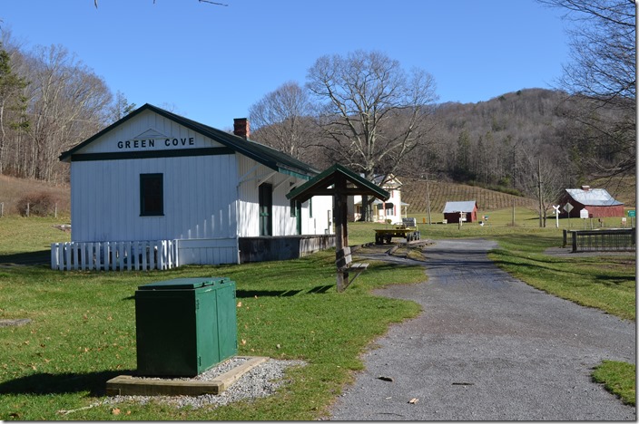
37. NW depot Green Cove VA. No need to explain this iconic location on the Abingdon Branch.
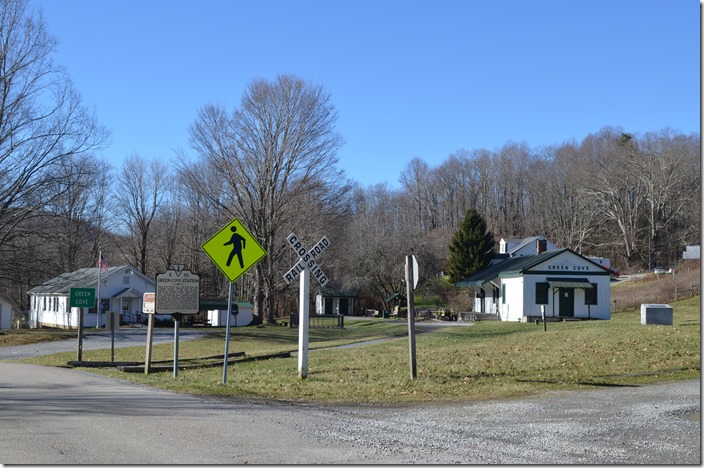
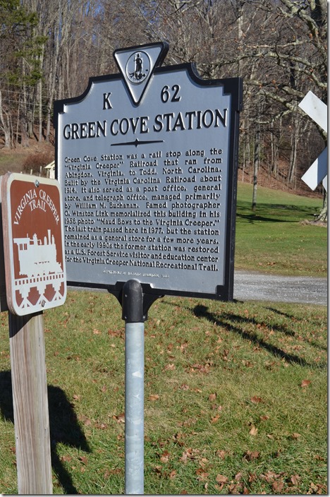
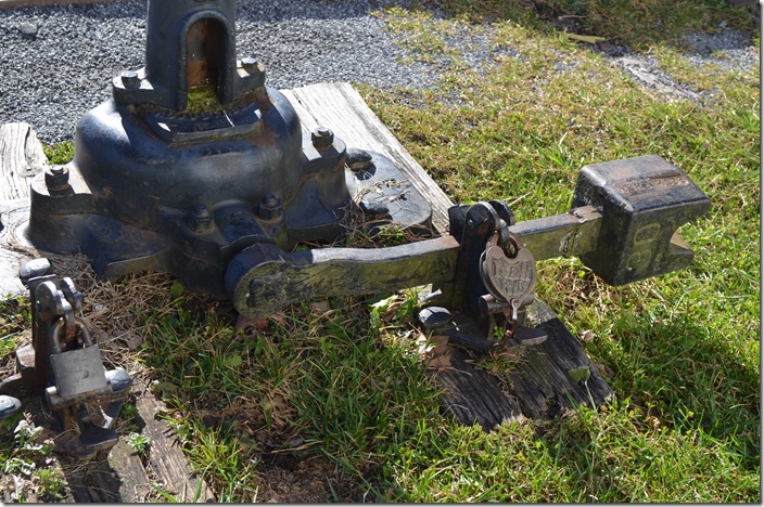
38. Historical marker closeup. Green Cove VA.
39. Historical monument. Green Cove VA.
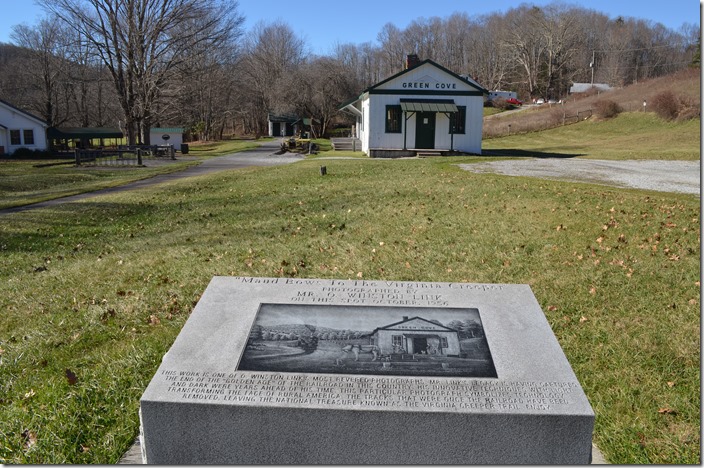
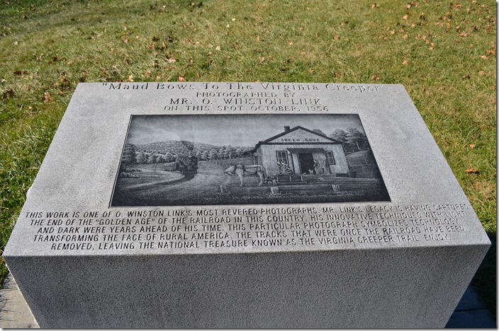
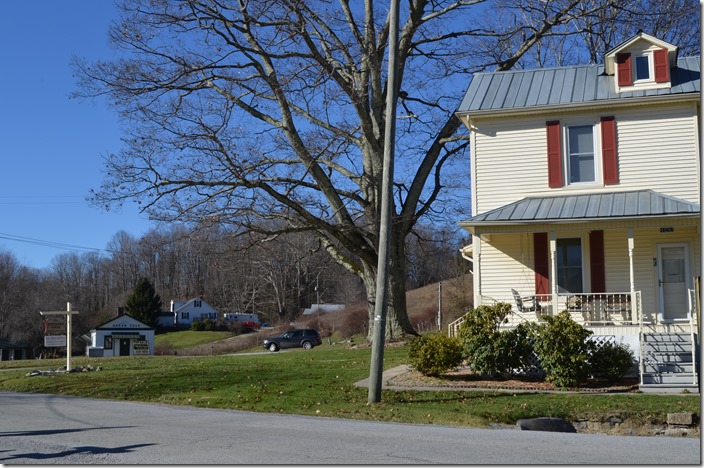
40. Historical monument. Closeup. Green Cove VA.
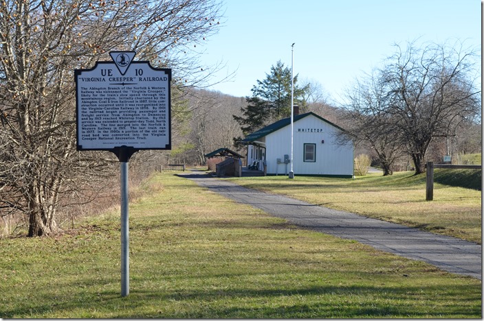
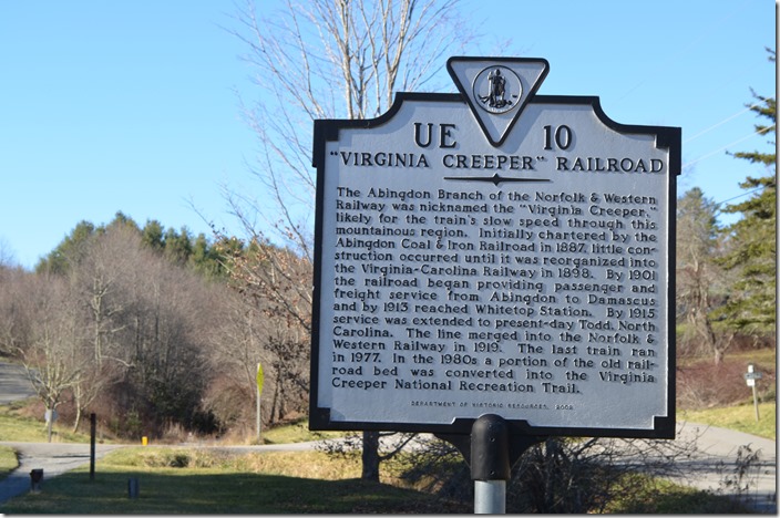
41. NW depot. Green Cove VA. View 2.
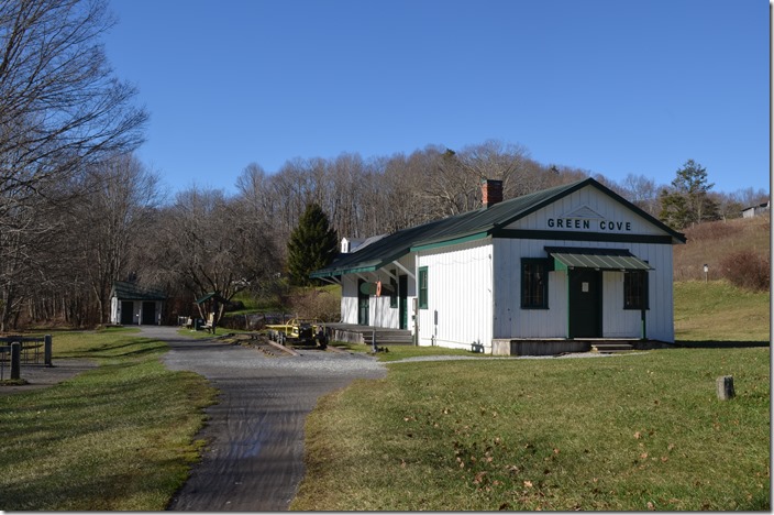
42. NW depot. Green Cove VA. View 3.
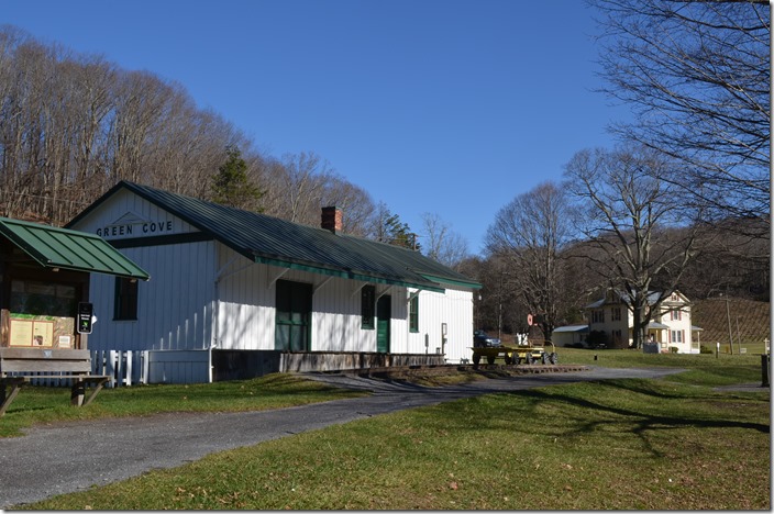
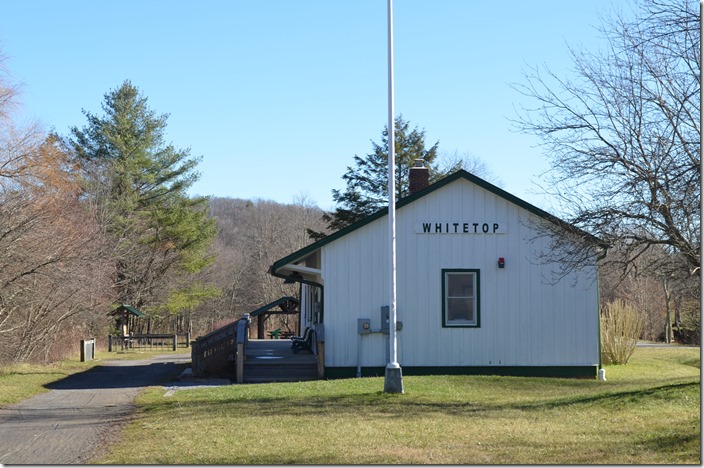
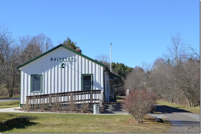
43. NW depot. Green Cove. View 4.
44. NW switch stand. Green Cove VA.
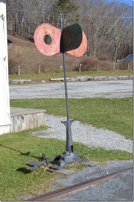
45. NW switch locks. Green Cove VA. Note the N&W heart shaped lock.
46. Buchanan house. Green Cove VA. The Buchanan home is up for sale.
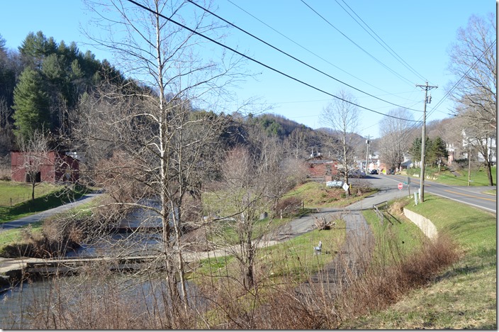
47. Historical marker. White Top. White Top was the highest point on the N&W. It is also the end of the Virginia Creeper Trail, as the old Abingdon Branch crossed into North Carolina south of here.
48. Historical marker. Closeup. White Top.
49. NW depot. White Top. The restored station is now a visitors center on the trail although it is closed between October and May.
50. NW depot. View 2. White Top. In North Carolina the former roadbed has not been developed into a contiguous trail.
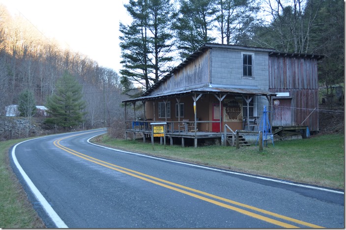
51. An old store building at Nella NC. The railroad was just to the left of the highway and crossed to the left side of the creek at this point. In Link’s day on the branch, the road was gravel.
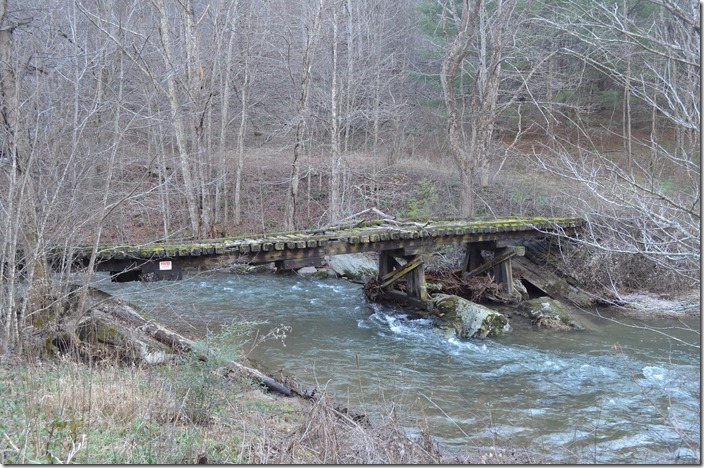
52. Abandoned bridge near Tuckerdale NC. Link photographed a double-header crossing this bridge northbound on page 81 of The Last Steam Railroad... NW bridge Tuckerdale NC.
53. The only landmark remaining from Link’s color photo in this view looking north at Lansing NC, is the red barn and bridge on the left. The abandoned roadbed is a walking track here. NW roadbed. Lansing NC.
54. The 10 miles between Lansing and West Jefferson has developed to the point that to traipse on the old roadbed might border on trespassing. This depot has been relocated from the actual alignment, but it is easy to determine where the railroad actually ran about one block off the main drag in West Jefferson. NW depot West Jefferson NC.
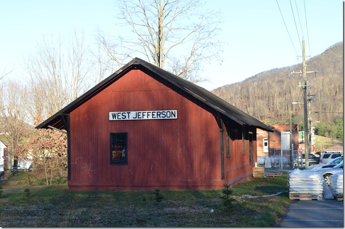
The Abingdon Branch once extended another 20 miles to Elkland NC (now called Todd) in the direction of Boone. It didn’t survive the Depression.
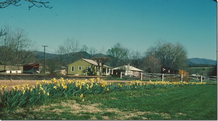
55. Ken Marsh was at Nella on 03-31-1977 when a pair of N&W Geeps made the last northbound revenue run. N&W Abingdon Br.
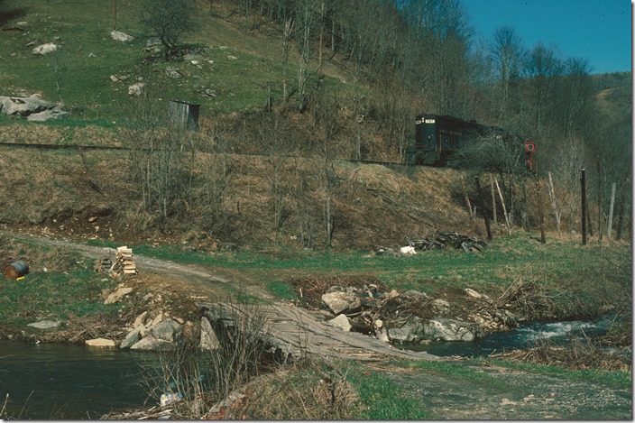
56. The saddest train of all is north of Damascus with a few freight cars. 03-31-1977. N&W Abingdon Br.
57. N&W USGS VA Konnarock Quadrangle Topographic map - 1935. In PDF format in order to view the attached notes. (9MB file).
Train images used by permission of Everett N Young